Preschool 4 Project Spotlight: Exploring the World Through Maps
Submitted By: The Preschool 4 Teachers
This spring, Preschool 4 set off on a journey to explore maps, places, and how we find our way in the world. What started with conversations around our classroom rug quickly grew into a full exploration of mapping — from familiar places to faraway ones and even imagined worlds.
We began by using our rug as a “rug map,” helping children find their spots for circle time and audience-style rows for story shares. This sparked questions about what maps are for, how they help us, and what symbols and legends mean. To build on this, we added photos and icons to our classroom schedule and talked about how maps use pictures to represent real spaces. As one child shared during a read-aloud of Follow That Map!: “It has pictures of places or things you want to see.”
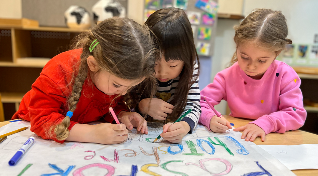
Soon, children began creating their own maps — some of treasure hunts and hidden paths, others of their bedrooms or homes. These personal and playful designs reflected how they were beginning to see maps as tools for storytelling and remembering.
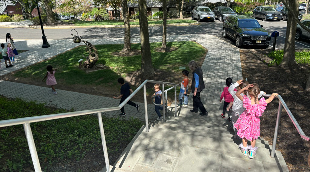
Our project expanded from the classroom to the campus. Using a printed D-E campus map and Google Maps, the children created their own versions and added symbols for places they recognized. During campus walks, they eagerly pointed things out: “That’s the bridge to lower school!” or “Those lines mean the stairs!” We also introduced a map of northern New Jersey. After finding our school’s location, children pinned photos of themselves to show where they live. They noticed patterns and asked questions about cities, rivers, and what it means to live “close” or “far.”
After spring break, families sent in maps from their travels. The children proudly shared what they noticed — some maps used colors, others used pictures or numbers — and all showed how different places organize space. We added these maps to our growing collection and pinned cities and countries onto a globe. “That’s half the world,” one child said while tracing their finger across a continent.
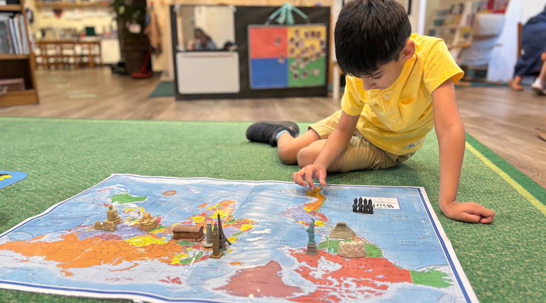
A favorite part of the project was exploring passports and landmarks. The children created their own passports, complete with names, birthdays, and photos and learned when and why people use them. Using landmark figurines and photos, they matched places like the Eiffel Tower and the Statue of Liberty to their spots on the world map. Then, using blocks and loose parts, they built these landmarks together. Each time they completed a build, they earned a stamp in their passport.
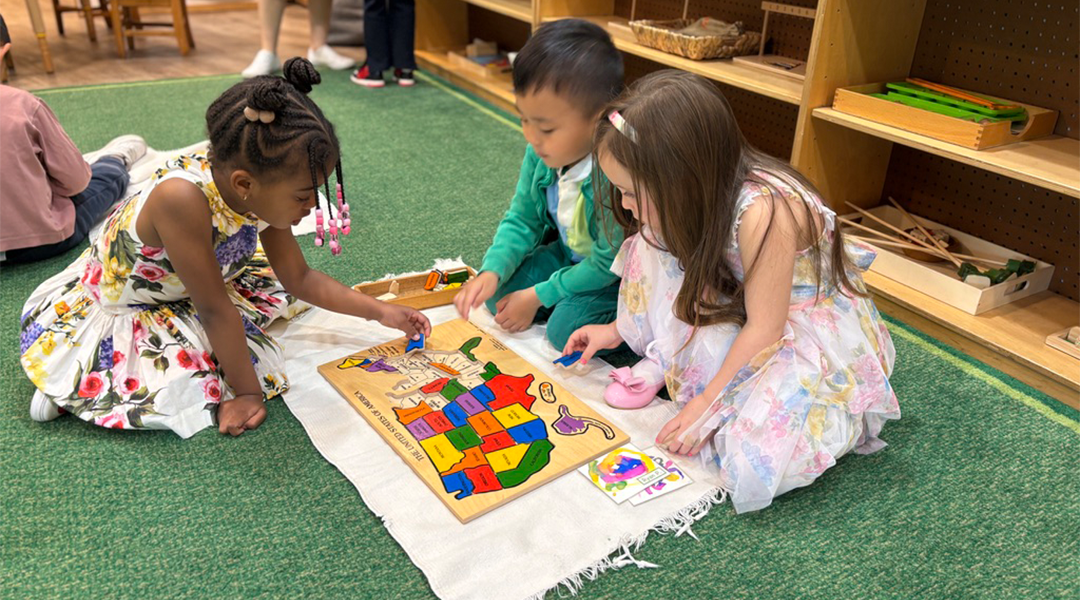
Our classroom was filled with excitement as the children worked with map puzzles — from world maps with animal cutouts to U.S. state puzzles and a continent of Africa puzzle. These hands-on activities helped them notice features of different places and develop spatial awareness. During our project, the children practiced identifying states during a “Map Snack,” where they matched state-shaped cookies to a projected map and colored in those states on their placemats. Throughout this project, we’ve followed the children’s curiosity, whether they were designing treasure maps, exploring campus landmarks, or talking about trips they’ve taken. It’s been a joyful, layered exploration of place, connection, and the world around us.